Photos Half Dome Delica

Joined
Jun 9, 2016
Messages
3,798
I spent a few days with my Delica on a trip recently. Here's a quick photo travel log for day 1. I'll upload day 2-4 as I have time to do so.

Ready to hit the road! About an hour late is right on schedule for us.

35DEA527-992B-4BB2-BE7F-661FC11D0076.JPG

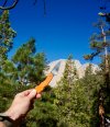
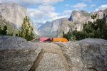
It was a long, long drive, but finally we were rewarded with this view! My son brought along his super awesome Native 5LW!
63A8BA03-0C0D-4827-B045-9B615816E127.JPG

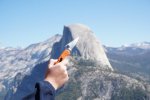
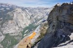
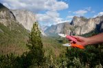
Tunnel overlook, Yosemite National Park. El Capitan is on the left. Half Dome is distant center. Bridal Veil falls is on the right (just above my thumb).
8B67A148-B714-4F1F-88E9-A3EBDAA05CCF.JPG

Traffic in the valley floor was horrible (Saturday afternoon). It took us about two additional hours to reach the backpackers campground near Half Dome Village. Sorry, no pics there to close out the day.

For those who don't know, if you have a Yosemite backcountry permit, there is a campground in the valley where you can stay the night before entry without additional reservation. I'm pretty sure you can stay there the night you come out as well. $6 per person. Someone WILL come around to check your backcountry permit.

Check back to the thread for day 2 & beyond!
 
Last edited:
Day 2: Glacier Point to Little Yosemite Valley (LYV).

Glacier Point is amazing! Aside from the view, it's a place to enter the backcountry from high ground.

Here's our goal as viewed from Glacier Point:

B624FB11-61A5-4922-BB3F-F1FF10B52E8D.JPG

The aptly named Panorama Trail starts with a two mile descent which helps the legs warm up and builds confidence. Distance to LYV campground is about 6.8 miles, and views are gorgeous most of the way!

EA971696-A17D-44DD-8D16-76DA7A31496F.JPG

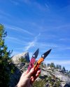
That's Half Dome to the left. Just to the right of the delica is Nevada falls. LYV campground is roughly 1.5 miles upstream from the falls. They had an early snow a week ago. It closed some passes on the JMT (John Muir Trail). Snowy peaks are in the distance. Weather was brisk! Great for hiking!

8C45A2B8-77EC-4042-9698-93544F6089F1.JPG

Obligatory Spydie-hole shot!

We made pretty good time to LYV, which is good because we left the trailhead about noon. We had just enough time for a qick dip in the VERY chilly Merced River while the sun was still high enough to dry off.

9212AD47-F7E0-4775-A462-8AE6316A3455.JPG

Notes from day 2: The only public transportation from the main Yosemite Valley floor to Glacier Piont is by way of a commercial tour bus. One way (hikers) tickets from the Yosemite Lodge to Glacer Point are $25 for adults, $15 for kids. You'll need advance reservations. Otherwise you're hitchhiking or coming out the same route (and missing the incredible Mist Trail). The Park Service trams don't service Glacier Point.

STILL TO COME: Days 3 & 4. (Might have to wait for tomorrow for those!)
 
Last edited:
Great thread, BD_01 BD_01 ! At my age it's nice to be along on a hike without having to use my legs. :rolleyes:

Cool that you've got enough signal to post out of there. I just got back from our Vermont place and there's so little there that posting is a huge PIA while we're up north.

Your orange Delica is much like my easy-to-find orange Endura woods and fields knife.

weopiYu.jpg
 
Cool that you've got enough signal to post out of there. I just got back from our Vermont place and there's so little there that posting is a huge PIA while we're up north.

Your orange Delica is much like my easy-to-find orange Endura woods and fields knife.

I got back last night, actually. It'll just take me a day or two to sort through my pics, so keep checking back--the trip just kept getting better!

I think there was cell signal for some carriers along the way. My phone, however, stayed in the truck with the rest of the BS that glues me to society! I need a happy place without that stuff.

As for easy to find, yes, orange is why I bought it and why it goes with me camping (though it's usually in my emergency kit--thus the Delica and not an Endura--though an Endura is on my mind!). Great color!

When my Varsity athelete son had to back out of the trip, I lost my porter and wound up having to carry extra weight--not good given my joints! So anyway, I had to shed weight where I could and my backup knife became my primary.
 
Last edited:
Terrible that those awesome pictures are broken up by all mountains in the background. I find the beautiful landscape distracting. :)
 
DAY THREE

This was the day we climbed Half Dome. It was awesome!

B3ACA861-1176-48C1-848E-9E54F37B5B41.JPG

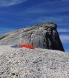
The distance from LYV to the summit of Half Dome is about 3.5 miles with an elevation gain of over 2,700 feet. In the pic above, the higher peak is the back of Half Dome. The smaller granite face to the right is sub-dome (at least that's what we call it).

341C9B4C-4B84-448A-85E1-80D2E2ACF417.JPG

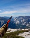
This is the saddle before sub-dome. Of all the great vistas, this may have been my favorite. To the right is a clear view of the main Yosemite Valley floor. My son's Native wanted to join this pic.

E4F2E470-DBF9-4F59-AA44-F03BBFD8EF51.JPG

The summit of sub-dome. If you want my opinion, the trail between the saddle and this point was built by Satan himself--it was that steep! The string of ants in the background are people ascending the final span of trail to Half Dome's summit. There are cables and boards to help people up a >60* slope! No knife pics on the cables. Loosing my lens cap was enough!

6B9E0092-BC73-4A5D-AF86-C5450FE1D670.JPG

The summit of Half Dome looking West. El Capitan is center on the right side of the valley.

20269848-13F6-443A-9AC7-00BB6F6C99DD.JPG

The summit, looking towards the north east end of the main valley floor.

887A99F5-07F1-4677-AFB7-5D4CB0FA2E7D.JPG

Back to LYV for our final night in the backcountry. Although today's round trip was only 7-ish miles, it took more out of me than expected. I was glad to not be walking out that night!

Check back for our final day of the trip. It may have been my favorite! It may have to wait until tomorrow for posting. ;)
 
Last edited:
Day 4 (Part 1)

The hike between LYV and Happy Isles via the Mist Trail was a fitting finale!
On the trail before 8:00 it wasn't even 40* yet, but it felt good to be moving.

B989B2DA-5C08-493F-ACA0-81AD313E33BC.JPG

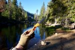
I had to pull over about half a mile upstream from Nevada Falls to grab a quick pic of the Merced River. What an awesome morning for a hike!

6A2744EE-9E5D-4295-AA30-38DB2AC79CC7.JPG

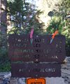
A trail sign! Only 2.5 miles more to the Valley floor? Doesn't sound like much, but there seemed to be endless narrow steep stone steps--with 40lbs on my back and a bad hip, this wasn't going to be a picnic!

FF7B5D43-31D7-494C-84B4-D4200D63964A.JPG

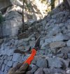
From this point the steep descent begins. Stone switchbacks were child's play compared to what was coming.

FBA0FEBF-77B1-4CCD-9106-A254E45E57E5.JPG

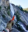
Endless rewards on the mist trail distracted me from burning quads..and glutes. A prime example is Nevada Falls!

80EAC7A9-CCD1-49B7-982D-5B05CD14BE2D.JPG

C'mon back for Part 2 of our final day!
 
Last edited:
Beautiful surroundings and pictures. I just love hiking and camping in the mountains!

The spydies are not bad either... :)
 
Day 4 Part 2: End of the Trail

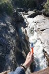
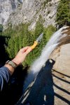
The mist trail follows the Merced River to the valley. There is only one bridge crossing. If it was less perilous it would make a great water slide.

1C7B8149-4130-4178-8467-1D6A53792A19.JPG

Vernal Falls was next. This is from the top:

D3CFB92F-5297-49E1-886C-24B1656C60FD.JPG

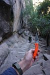
Stairs like this seemed to stretch forever! My hiking poles were a necessity, given the load on my back. I went slowly. There's no recovering froma fall.

94E56385-EFC6-4C3D-B3F5-4526A0740332.JPG

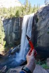
I've been to some neat places. I don't think any are better than the stretch of trail near Vernal Falls.

F6B03A79-579A-497A-8735-1C8FF0EB2977.JPG

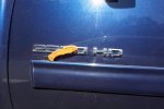
I always like seeing my truck. At the end of a backpacking trip, I LOVE seeing my truck. (I gotta get that trim strip fixed!)

9F99E426-985E-444D-A167-6AD50FA97371.JPG

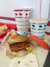
It's bittersweet, however. The end of a trail signifies a return to the rat-race; immersion in a society that's too fast paced, too bright, too loud. There are some benefits to look forwad to though!

IMG_2225.JPG

Thanks for reading about my trip. I hope you enjoyed the photos.
 
Last edited:
Thanks much for posting 4mer, loved the pics! Yosemite is at the top of my list of places to see.
 
What a great trip! Thanks for sharing the awesome pics! I havent been there since camping trips as a kid.
 
Half Dome is a great dayhike, everyone should try it at some point.

And you got the chocolate shake at InNOut; that is my favorite thing they sell.
 
And you got the chocolate shake at InNOut; that is my favorite thing they sell.

Don't give up until you try Chicolate-Strawberry!

Thanks for the kind words, folks. It took me about 4 trys to get a permit--all tries were for after Labor Day. Turns out we hit it perfectly.
 
Back
Top