-
The BladeForums.com 2024 Traditional Knife is ready to order! See this thread for details: https://www.bladeforums.com/threads/bladeforums-2024-traditional-knife.2003187/
Price is $300 ea (shipped within CONUS). If you live outside the US, I will contact you after your order for extra shipping charges.
Order here: https://www.bladeforums.com/help/2024-traditional/ - Order as many as you like, we have plenty.
You are using an out of date browser. It may not display this or other websites correctly.
You should upgrade or use an alternative browser.
You should upgrade or use an alternative browser.
The Sunday Picture Show (October 22nd, 2023)
- Thread starter DeSotoSky
- Start date

Old Hunter
Gold Member
- Joined
- Jul 12, 2012
- Messages
- 9,634
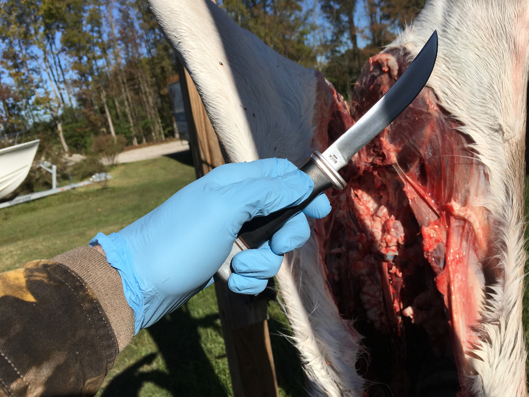
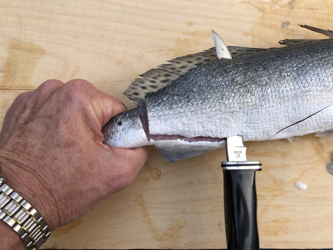
That last group of my pictures was the Buck 118 all clean and pretty in staged pictures (glamour shots). Here are some at use photo's of different Buck 118 Personals in their work-a-day role. OH

- Joined
- Apr 20, 2022
- Messages
- 1,300
jmh33
Gold Member
- Joined
- Mar 16, 2003
- Messages
- 9,488
AWESOME!!


John

- Joined
- Aug 21, 2013
- Messages
- 1,549

bertl
Gold Member
- Joined
- Feb 17, 2011
- Messages
- 2,398
Where is this marker? Is it a result of the 1926 Supreme Court case trying to settle the Wisconsin-Michigan state line dispute?
- Joined
- Aug 21, 2013
- Messages
- 1,549
The marker is right by the shore line on Lac Vieux Desert on Duck Point. Most of the point is Michigan but the end is Wisconsin.
This is the only info I found about it.
The US government thought that they could use rivers to separate the Upper Peninsula from Wisconsin. This mostly works with the Menominee and Brule Rivers emptying into Lake Michigan. However, there is a gap from where the Brule River starts at Brule Lake to where the Montreal River empties into Lake Superior. Cram’s job was to draw a straight line between the two spots. The Treaty Tree marks the start of this line at the headwaters of the Brule River. Surveyors often carved into trees to mark special spots and that is exactly what Cram did. The Tamarack tree he chose is dead and preserved at a museum in Marquette. As you can read below, the idea of land ownership and precisely defining state borders was lost on the Ojibwa (Chippewa) indigenous people of the time. I don’t think future surveyors left gifts for them at the site. Cram sent his report to Congress and the border was redefined. Instead of rivers separating the two states, a section would be a land border.
William A. Burt came back in 1847 to make it official and a monument is in place marking “Mile Zero”, which is the start of the land border between the Brule River, going to Lac View Desert and continuing to the Montreal River and eventually Lake Superior. In 1928 a Joint Border Commission put in the plaque.
Last edited:

DOGPOUND77
Gold Member
- Joined
- Sep 4, 2017
- Messages
- 2,140


bertl
Gold Member
- Joined
- Feb 17, 2011
- Messages
- 2,398
Thanks, I found this:The marker is right by the shore line on Lac Vieux Desert on Duck Point. Most of the point is Michigan but the end is Wisconsin.
"A Supreme Court decision on November 22, 1926 (Michigan v. Wisconsin 272 US 398) awarded a sliver of land to Wisconsin. The dispute arose because the original 1836 boundary description referenced a situation that did not exist: The referenced Montreal River did not originate from the Lake of the Desert."
- Joined
- Apr 20, 2022
- Messages
- 1,300
Man, you own some super nice knives.Yep...love the look...


- Joined
- Apr 20, 2022
- Messages
- 1,300
I love turquoise. Very nice.
- Joined
- Apr 20, 2022
- Messages
- 1,300
Thank you.AWESOME!!
John
bertl
Gold Member
- Joined
- Feb 17, 2011
- Messages
- 2,398
We seem to have quite a bit of turquoise, but only a little on knives. My wife taught on the Navajo Reservation and then at Taos Pueblo. Buying a few pieces of jewelry every once in a while mounts up over 25 years.I love turquoise. Very nice.
Bert
pjsjr
Gold Member
- Joined
- Jan 2, 2005
- Messages
- 7,313
Thank you, I feel/am fortunate for sure.Man, you own some super nice knives.
View attachment 2364636Does anyone have any pics of Bucks with the flint knapped appearance?
That knapping is done free hand on a belt running over a small wheel.
Last edited:


bertl
Gold Member
- Joined
- Feb 17, 2011
- Messages
- 2,398
I have one and it's one of my favorites.Buck of the Month Feb 2021. I've been carrying this 347 Vantage lately. Slick opening and sharp as heck. Feels right in my hand.
Bert