Awesome knife, awesome photo! Hope you have another great day my friend!


Gracias mi amigo
Went for a short hike this morning... already 90 degrees outside.
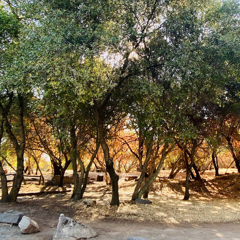
Had the Usual Lamb in my pocket...
Cool
…. I mean HOT pics John

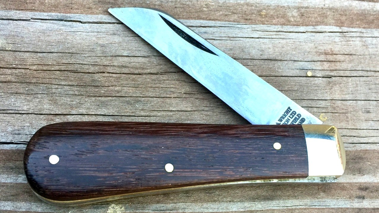
The African Rosewood wood shows the patina of a well used and loved knife
Dan,
I'm truly enjoying you sharing your adventure with us. Thanks and keep up the reports!
I'm surprised to hear that there is
anything that the Grohmann doesn't excel at.
Recently because of the excessive heat around here, I discovered that to take a nature walk, I don't need to venture as far as I use too. Here's a bit of wildlife I spotted during a nature walk on my patio.
")
") Nature's Polished Gemstone
Nature's Polished Gemstone
This Ebony Scout was in my pocket during the entire above mentioned walk and is shown here the way I like to think about it during these heat waves.
Enjoy your excursion Dan.
Thank you my James

Great pics of your garden gems my friend
I baby my Grohmann a bit too much and keep reaching for an old little fillet knife that’s been in my tackle box for ever.
I think it’s time it grew up… it’s called Bird and Trout after all

Ok Dan
 CelloDan
, I’m going to pester you with some more questions:
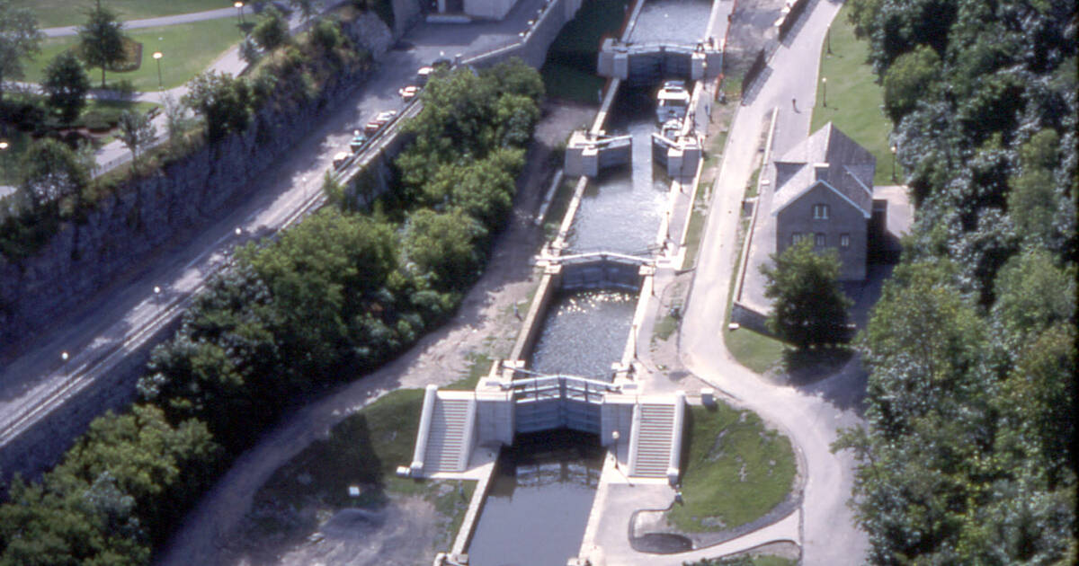
When navigating the lakes, is the canal route obvious from boat traffic, or are you using GPS (or chart and compass) to navigate? Are there landmarks like towns maybe? Are there buoys or lights directing you to the locks? You can wait until you get back to answer - I don’t want to disturb your peaceful trip.
Hi Tom, the deep part of the canal is marked every so often with color coded buoys ( green and orange)
Big boats better stick to it to ensure they don’t run aground .
When going downstream the green should be on your right and the orange on your left.
Today I am at Newboro, the highest point of the system which means that is downstream both ways from the lock ( if you are passing through it the water flow is then reversed)
There is a sign to reming boaters going trough the lock that the colors are about to revert as they keep boating
The portion of the system I am doing over this 5 days connects some big lakes
It can get a bit rough in the middle if windy ( plus the wake of some huge boats speeding past is not nice and just rude sometimes, not to mention the erosion they cause on the shores)
So smaller craft often hug the shores more when windy and/or take shortcuts in between islands.
I don’t take charts or compass with me ( just a basic map)
Last year I got a bit lost twice, no big deal except that I had two frustrated teenagers on their kayaks who did not appreciate the extra paddle in the hot July weather

Because there was no cell reception I could not rely on my phone.
This year I pre downloaded the Google maps at home and saved them to my phone. Now, even with no cell reception I can navigate without issues ( I have a battery bank in the boat to charge my phone)
This year though everything seems almost too easy. I am able to remember the trouble spots as I pass them a second time and there is no anxiety LOL ( neither two frustrated teenagers lol

)
Loving your adventures, Dan, and check in multiple times a day just to see if you've posted. Thanks for taking the time and sharing with us all!

There are few things better than a good nights sleep or freshly caught fish nuggets.
Gracias Mark
(update is upcoming
)


 … but it would not have anything to do with cleaning fish
  this morning to finish digestion


 ️
️ 


![51303557023_8518012ae1_b.jpg[IMG]](https://live.staticflickr.com/65535/51303557023_8518012ae1_b.jpg[IMG])
![51303557083_42b292ed1f_h.jpg[IMG]](https://live.staticflickr.com/65535/51303557083_42b292ed1f_h.jpg[IMG])